| PETERVANHAM.COM BIOGRAPHIES BOOKS MUSIC / FILM PUBLICATIONS & LECTURES NORTHEAST INDIA WESTERN HIMALAYAS PHOTO-ARCHIVES UPCOMING CONTACT |
||||||
N U B R A
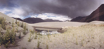
NUBRA - transition zone between the Himalaya and the sands of Central Asia
The highest of these mountains, the 7742 metres high Saltoro Kangri towers above a place of tragic reputation: Nubra has the highest warplace on earth. It is the 70 kms long and 5500 metres high Siachen glacier, app. 30 kms from Panamik, in the upper reaches of the Nubra river, where in the early 80‘s Indian soldiers had penetrated into the neighbouring Baltistan in order to get back the areas, that had been occupied by Pakistan between 1948 and 1971. Since nobody had thought that a war in such altitudes would be possible, the exact borderline between India and Pakistan had not been defined in the truce of 1971, which has resulted in constant fightings ever since. Even in summer the temperature remains below 00 Celsius on Siachen, in winter it drops down to minus 500 Celsius. In an area like this it is therefore only natural that since the begin of the war both parties have lost more soldiers‘ lives because of avalanches, in glacier cracks, through snow blindness, freezing and acute mountain sickness than because of fightings.
The people in the heart of Nubra are predominantly Buddhists. Their religious life concentrates upon a few monasteries of which Deskit, due to its location on top of a steep mountain high above the village of the same name, is the most impressive one. App. 80 monks live in its 570 years old labyrinth-like buildings that are approached along endless lines of chorten and mani-walls, on which a number of beautifully incised tablets may be found. Next to a monastery of recent origin, Hundar, the foremost capital of Nubra, owns two temples of considerable age and importance: The Red temple and the White temple that stand on a spur of the mountain behind Hundar were supposedly built by Rinchen Zangpo in the 11th century AD. Various inscriptions, especially in the Red temple, as well as the style of some paintings depicting historic scenes, support this thesis, although most of the walls‘ paintings are definitely younger than 11th century. The third monastery of importance lies a little east of the village of Panamik.
But not all of the inhabitants of Nubra are Buddhists. Travelling Shyok-upwards one reaches the Islamic communities of Turtuk and Bogdang that form the transition zone to the neighbouring Baltistan which lies already on Pakistan territory.
Not much is known about the history of Nubra. It appears that Nubra (literally translated as the ”Western realm”) has been a province of Ladakh since 1400. Before that time Nubra was ruled by its own kings. Inscriptions at Hundar‘s Red temple speak of local gyalpos who resided in a palace of the Hundar village below. Their palace is still in existence and may be visited in arrangement with the monks of the new monastery. Because of the two regions‘ vicinity it seems probable that there have been links between Nubra and the neighbouring Baltistan: before becoming a part of Ladakh, Nubra was a part of a kingdom called Khapolor, which extended from Nubra into parts of Eastern Baltistan and whose rulers may be traced back until a sultan by the name of Sikander, which is the regional name for Alexander the Great... Yet it is known that the 16th century‘s Islamic invasions from Baltistan side were heroically defeated near Hundar which resulted in the sparing of Ladakh from destruction and plundering.
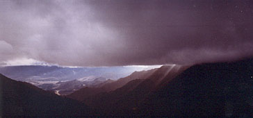
Crossing the Khardung-la from Nubra back into the Indus Valley
BUDDHA´S MOUNTAIN DESERT
The Secret Tibetan Heritage in the Himalayas
THE FORGOTTEN GODS OF TIBET
Early Buddhist Art in the Western Himalayas
ON THE PATHS OF THE BUDDHA
2000 kms through the Western Himalayas (in German language)
on the Western Himalayas:
KINNAUR, SPITI, TABO MONASTERY,
LAHAUL, CHANGTHANG, NUBRA